

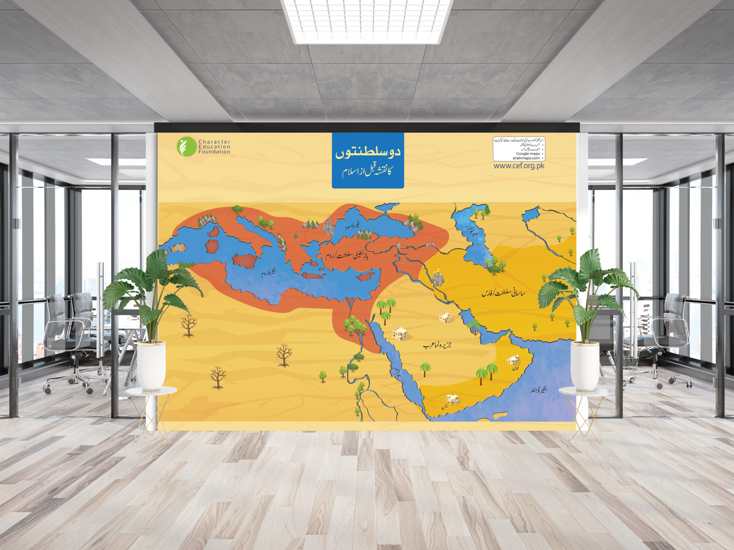

Seerah Map: The World at the Dawn of Islam
Rs 800.00
Description:
Salient Features of This Seerah Map:
- Historical Representation – Showcases the world at the dawn of Islam, highlighting the Roman and Persian Empires.
- Educational & Informative – Clearly marks key cities, trade routes, and significant historical locations.
- Easy-to-Understand Design – Simplified visual layout for students, educators, and history enthusiasts.
- Geographical Accuracy – Displays major rivers, deserts, and landscapes relevant to Islamic history.
- Visual Storytelling – Engaging graphics help learners connect with historical events and locations.
- Premium Quality Print – High-resolution, durable material perfect for classrooms, libraries, and homes.
- Ideal for Islamic Studies – A valuable resource for Seerah studies, helping learners connect with history.
Learning Outcomes:
Learners will develop a deeper understanding of the historical context of early Islam, including the empires, regions, and key events of the time.